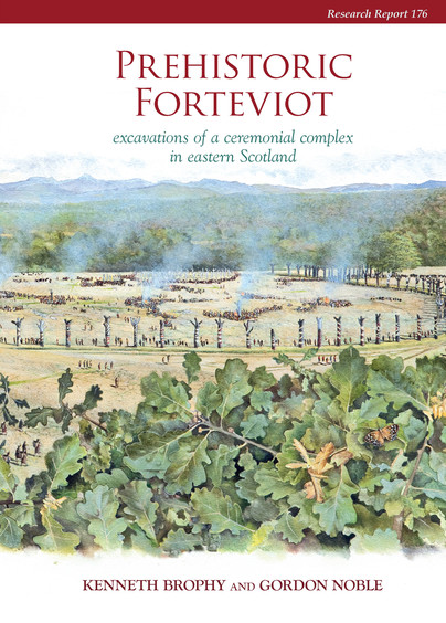
Format: Hardback
Pages: 336
ISBN: 9781909990043
Pub Date: 30 Sep 2021
Imprint: Council for British Archaeology
Series: CBA Research Report
Illustrations: 249 illustrations
Description:
A detailed report on the excavation of prehistoric features at Forteviot in eastern Scotland by the University of Glasgow's Strathearn Environs and Royal Forteviot (SERF) Project. Details include an extensive prehistoric landscape including a Neolithic cremation cemetery, large pit-defined enclosure, early Bronze Age henge monuments, and a Bronze Age dagger-cist burial. The monuments appear to have survived into the early historic period and were modified in the first millennium AD.
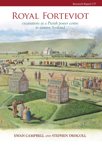
Format: Hardback
Pages: 272
ISBN: 9781909990050
Pub Date: 30 Sep 2021
Imprint: Council for British Archaeology
Series: CBA Research Report
Illustrations: 163 illustrations
Description:
A detailed report on excavation of early historic features at Forteviot in eastern Scotland by the University of Glasgow's Strathearn Environs and Royal Forteviot (SERF) Project. Features include a potential royal palace and early church, with a discussion of their relationship with prehistoric remains. This report also includes a detailed analysis of early medieval sculpture from the Forteviot area.
Format: Hardback
Pages: 296
ISBN: 9781789256239
Pub Date: 15 Sep 2021
Illustrations: B/w
Description:
Winchester’s identity as a royal centre became well established between the ninth and twelfth centuries, closely tied to the significance of the religious communities who lived within and without the city walls. The reach of power of Winchester was felt throughout England and into the Continent through the relationships of the bishops, the power fluctuations of the Norman period, the pursuit of arts and history writing, the reach of the city’s saints, and more. The essays contained in this volume present early medieval Winchester not as a city alone, but a city emmeshed in wider political, social, and cultural movements and, in many cases, providing examples of authority and power that are representative of early medieval England as a whole.
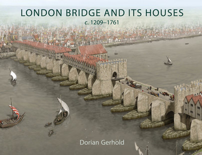
Format: Hardback
Pages: 224
ISBN: 9781789257519
Pub Date: 10 Sep 2021
Illustrations: B/w and colour
Description:
London Bridge lined with houses from end to end was one of the most extraordinary structures ever seen in London. It was home to over 500 people, perched above the rushing waters of the Thames, and was one of the city’s main shopping streets. It is among the most familiar images of London in the past, but little has previously been known about the houses and the people who lived and worked in them.
This book uses plentiful newly-discovered evidence, including detailed descriptions of nearly every house, to tell the story of the bridge and its houses and inhabitants. With the new information it is possible to reconstruct the plan of the bridge and houses in the seventeenth century, to trace the history of each house back through rentals and a survey to 1358, revealing the original layout, to date most of the houses which appear in later views, and to show how the houses and their occupants changed during five and half centuries. The book describes what stopped the houses falling into the river, how the houses were gradually enlarged, what their layout was inside, what goods were sold on the bridge and how these changed over time, the extensive rebuilding in 1477-1548 and 1683-96, and the removal of the houses around 1760.There are many new discoveries - about the structure of the bridge, the width of the roadway, the original layout of the houses, how the houses were supported, the size and internal planning of the houses, the quality of their architecture, and the trades practised on the bridge. The book includes five newly-commissioned reconstruction drawings showing what we now know about the bridge and its houses.
Format: Hardback
Pages: 568
ISBN: 9781789256932
Pub Date: 15 Aug 2021
Series: Sheffield Environmental and Archaeological Research Campaign in the Hebrides
Illustrations: Colour
Description:
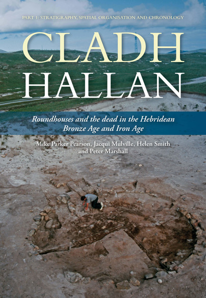
This first of two volumes presents the archaeological evidence of a long sequence of settlement and funerary activity from the Beaker period (Early Bronze Age c. 2000 BC) to the Early Iron Age (c. 500 BC) at the unusually long-occupied site of Cladh Hallan on South Uist in the Western Isles of Scotland.
Particular highlights of its sequence are a cremation burial ground and pyre site of the 18th–16th centuries BC and a row of three Late Bronze Age sunken-floored roundhouses constructed in the 10th century BC. Beneath these roundhouses, four inhumation graves contained skeletons, two of which were remains of composite collections of body parts with evidence for post-mortem soft tissue preservation prior to burial. They have proved to be the first evidence for mummification in Bronze Age Britain. Cladh Hallan's remarkable stratigraphic sequence, preserved in the machair sand of South Uist, includes a unique 500-year sequence of roundhouse life in Late Bronze Age and Iron Age Britain. One of the most important results of the excavation has come from intensive environmental and micro-debris sampling of house floors and outdoor areas to recover patterns of discard and to interpret the spatial use of 15 domestic interiors from the Late Bronze Age to the Early Iron Age. From Cladh Hallan’s roundhouse floors we gain intimate insights into how daily life was organized within the house - where people cooked, ate, worked and slept. Such evidence rarely survives from prehistoric houses in Britain or Europe, and the results make a profound contribution to long-running debates about the sunwise organisation of roundhouse activities. Activity at Cladh Hallan ended with the construction and abandonment of two unusual double-roundhouses in the Early Iron Age. One appears to have been a smokery and steam room, and the other was used for metalworking.
Format: Paperback
Pages: 288
ISBN: 9781914427046
Pub Date: 10 Aug 2021
Imprint: Windgather Press
Illustrations: B/w and colour
Description:
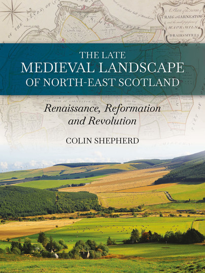
The landscape of the north-east of Scotland ranges from wild mountains to undulating farmlands; from cosy, quaint fishing coves to long, sandy bays. This landscape witnessed the death of MacBeth, the final stand of the Comyns earls of Buchan against Robert the Bruce and the last victory, in Britain, of a catholic army at Glenlivet. But behind these momentous battles lie the quieter histories of ordinary folk farming the land - and supping their local malts.
Colin Shepherd paints a picture of rural life within the landscapes of the north-east between the 13th and 18th centuries by using documentary, cartographic and archaeological evidence. He shows how the landscape was ordered by topographic and environmental constraints that resulted in great variation across the region and considers the evidence for the way late medieval lifestyles developed and blended sustainably within their environments to create a patchwork of cultural and agricultural diversity. However, these socio-economic developments subsequently led to a breakdown of this structure, resulting in what Adam Smith, in the 18th century, described as 'oppression'. The 12th-century Renaissance, the Protestant Reformation and the Industrial Revolution are used here to define a framework for considering the cultural changes that affected this region of Scotland. These include the dispossession of rights to land ownership that continue to haunt policy makers in the Scottish government today. Whilst the story also shows how a regional cultural divergence, recognised here, can undermine 'big theories' of socio-political change when viewed across the wider stage of Europe and the Americas.
Format: Hardback
Pages: 168
ISBN: 9781911188926
Pub Date: 15 Jul 2021
Imprint: Windgather Press
Illustrations: Colour
Description:
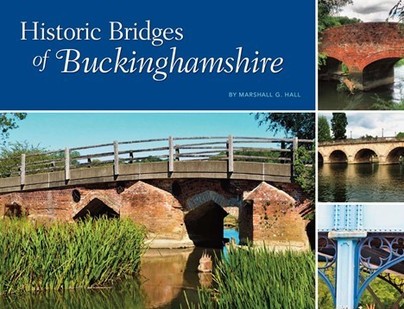
Bridges have always played an important role on the social and economic history of human development, and Buckinghamshire has a great wealth of them. Trade systems and road networks must solve the challenges of geography’s waterways, and bridges, causeways, fords, and flood systems were necessarily a key aspect of the experience of historical travel. Bridges and river crossings anchored the Buckinghamshire road network in the landscape, and once established it proved remarkably durable.
Settlements, villages, and eventually cities have traditionally sprung up at bridgeheads or where a river could be crossed at any time of the year. Some examples in Buckinghamshire are Newport Pagnell, Buckingham, and Cookham. The most ancient, vital, and interesting architectural structures linked to use of these crossings are bridges, and people hold a deep fascination for them. There are literally thousands of bridges in Buckinghamshire, varying vastly in size, style, and materials. Many are stone, a few are wooden, and thereare numerous brick and more modern steel and concrete constructions. The bridges featured in this book are more than 100 years old, mostly lie on public roads or rights-of way, are publicly accessible, and have a significant proportion of the original bridge intact. Through colour photographs, stories, and historical facts, this book looks at the wonderful historic bridges that make up the chronology of Buckinghamshire.
Format: Paperback
Pages: 74
ISBN: 9780905594569
Pub Date: 05 Jul 2021
Imprint: East Anglian Archaeology
Series: East Anglian Archaeology Monograph
Illustrations: 37
Description:
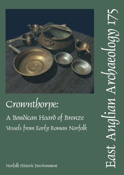
The Crownthorpe hoard was discovered in 1982 during a metal detector search of a Roman temple site. It consists of seven bronze vessels: native copies of two Roman silver wine cups and a spouted strainer bowl, together with an imported Roman saucepan, patera and a pair of dishes. The cups are copies of plain silver vessels of form Eggers 170, and may well have been made in a workshop in Norfolk.
They are the only complete examples of insular copies of Roman wine cups from Britain. Copies of Roman wine cups were made in the east of England from before c. 25 BC. Some of these local imitations were inspired by imported cups that have not survived in the archaeological record. Bearing in mind that no imported silver plate is known from late Iron Age Britain after c. 10 BC, insular copies of wine cups show that more silver plate reached Iron Age Britain than we have hitherto realised. Confirmation comes from images of Roman silver cups on Iron Age coins. The spouted strainer bowl was made in a workshop to the south of Crownthorpe, somewhere in the counties north of the lower Thames. Such vessels are an insular type that owed nothing significant to the Roman world. They were used primarily for flavouring local drinks. A corpus of thirty-one such copper-alloy vessels is provided here, including three examples that reached the mainland of Europe. The Roman saucepan in the hoard is an Eggers 151 saucepan of Trau-Kasserolle type. They are rare finds: Crownthorpe is only the fourth example from Britain, and the only complete one. It came from a workshop along the Rhine or Danube frontiers. The patera is Italian and part of a set of hand-washing vessels; the jug that would have been used in conjunction with it was not present in the hoard. The two dishes have tinned inner surfaces and represent a long-lived Roman vessel type. The hoard was assembled at Crownthorpe c. AD 40-75. Relating the hoard to the local context suggests that the date can be narrowed down to c. AD 45-60/61. It was buried by a Briton, a member of the local Icenian elite. The set of vessels at Crownthorpe was used for preparing and serving local ale or mead flavoured with fruit or vegetable additives, and drunk from the cups. Wine amphoras are seldom found in late Iron Age and early Roman Norfolk, and that precludes the use of the Crownthorpe cups for the drink. As there are two cups, we should envisage their use for the host and a guest. The Eggers 151 saucepan was used to ladle the drink into the strainer bowl for its flavouring. Snacks to accompany the drink were served in the two dishes. Hand-washing in the course of these revelries was facilitated by the patera. Burial of the hoard near the site of a later Romano-Celtic temple with no trace of an organic container to facilitate recovery suggests it was votive. Other base-metal utensil hoards from Roman Britain cannot be satisfactorily accounted for as the temporary concealment of portable wealth with the intention of recovery, and strengthen the case for Crownthorpe being votive. No comparable hoards are known from late Iron Age Britain because few copper-alloy utensils were in use then, but we know that the practice of burying such hoards had its roots in a native tradition because single copper-alloy vessels have been recovered from watery contexts in the late Iron Age. Components of the Crownthorpe hoard had been dismantled when it was buried, but it should not be seen as a hoard of scrap metal intended for recycling. It is proposed instead that the termination of the useful working life of the hoard vessels represents an act of renunciation, in this case a repudiation of Icenian dealings with the Roman world that culminated in the calamity of the Boudican Revolt of AD 60-61.
Format: Hardback
Pages: 256
ISBN: 9781789257359
Pub Date: 23 Jun 2021
Illustrations: Colour
Description:
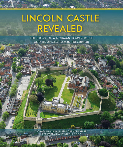
This highly-illustrated book reveals a brand-new story of the royal castle of Lincoln – how it was imposed on the late Anglo-Saxon town and how it developed over the next 900 years in the hands of the king or his aristocratic associates. Today, we have been left a surviving monument of three great towers, each with its own biography. Led by FAS Heritage, archaeologists, architectural historians and a large cohort of the general public have come together to produce a revealing and accessible account of the story of Lincoln Castle; in doing so, we gain further insight into the history, culture and society of medieval England.
Format: Hardback
Pages: 240
ISBN: 9781789256895
Pub Date: 15 Jun 2021
Illustrations: Colour and b/w
Description:
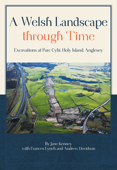
Holy Island is a small island just off the west coast of Anglesey, North Wales, which is rich in archaeology of all periods. Between 2006 and 2010, archaeological excavations in advance of a major Welsh Government development site, Parc Cybi, enabled extensive study of the island’s past. Over 20 hectares were investigated, revealing a busy and complex archaeological landscape, which could be seen evolving from the Mesolithic period through to the present day.
Major sites discovered include an Early Neolithic timber hall aligned on an adjacent chambered tomb and an Iron Age settlement, the development of which is traced by extensive dating and Bayesian analysis. A Bronze Age ceremonial complex, along with the Neolithic tomb, defined the cultural landscape for subsequent periods. A long cist cemetery of a type common on Anglesey proved, uncommonly, to be late Roman in date, while elusive Early Medieval settlement was indicated by corn dryers. This wealth of new information has revolutionised our understanding of how people have lived in, and transformed, the landscape of Holy Island. Many of the sites are also significant in a broader Welsh context and inform the understanding of similar sites across Britain and Ireland.
Format: Paperback
Pages: 374
ISBN: 9781911188759
Pub Date: 15 Jun 2021
Imprint: Windgather Press
Illustrations: B/w and colour
Description:
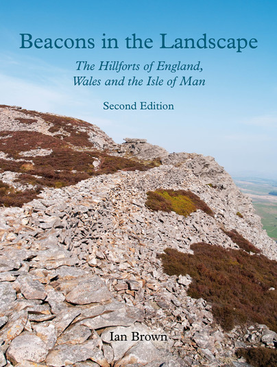
Of all of Britain's great archaeological monuments the prehistoric and later hillforts have arguably had the most profound impact on the landscape, if only because there are so many; yet we know very little about them. Were they recognised as being something special by those who created them or is the ‘hillfort’ purely an archaeologist's 'construct'? How were they built, who lived in them and to what uses were they put?
This book, which is richly illustrated with photography of sites throughout England and Wales, addresses these and many other questions. After discussing the difficult issue of definition and the great excavations on which our knowledge is based, Ian Brown investigates in turn the origins of hillforts, their architecture and the role they played in Iron Age society. He also discusses the latest theories about their location, social significance and chronology. The book provides a valuable synthesis of the rich vein of research carried out in England and Wales on hillforts over the last thirty years. The great variability of hillforts poses many problems, and this book should help guide both the specialist and non-specialist alike though the complex literature. Furthermore, it has an important conservation objective. Land use in the modern era has not been kind to these monuments, with a significant number either disfigured or lost. Public consciousness of their importance needs raising if their management is to be improved and their future assured.
Format: Paperback
Pages: 76
ISBN: 9780956874764
Pub Date: 10 Apr 2021
Imprint: East Anglian Archaeology
Series: East Anglian Archaeology Monograph
Illustrations: 37
Description:
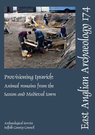
This volume presents the results of the zooarchaeological analysis of animal bones that were recovered from sixteen sites in Ipswich between 1974 and 1988. The focus of the study is on the animal bones from Middle Saxon (700-850/880), Early Late Saxon (850/880-920), Middle Late Saxon (920-1000) and Early Medieval (1000-1150) sites that were part of the Origins of Ipswich project.The faunal assemblages from all four periods were composed primarily of cattle, caprines (sheep and goats), pigs, and domestic chickens.
Horses were few in number and do not seem to have formed part of the diet after the Middle Saxon period. In terms of NISP (Number of Identified Specimens Per taxon), cattle are always the most numerous animals, followed by pigs and then caprines, but the relative number of sheep and goats increases throughout the Middle Saxon, Late Saxon and Medieval periods. Domestic chickens greatly outnumber domestic geese in all periods. Wild birds and mammals are rare in all the Ipswich assemblages. The most common wild species are red deer (Cervus elaphus) and roe deer (Capreolus capreolus). Biometrical data show that the Middle Saxon cattle are comparable in size to the cattle from other Middle Saxon emporia in England. These data also suggest that fewer oxen were sent to market in the later periods and that there was a slight overall decrease in the size of cattle by the Early Medieval period. The Middle Saxon sheep from Ipswich are small and comparable in size to the Middle Saxon sheep from rural East Anglian sites such as Brandon in Suffolk. All the Ipswich horses are the size of large ponies; most are between 130 and 140cm (about 13-14 hands) in withers height. The dog remains from the Late Saxon and Early Medieval contexts in Ipswich include dogs of a range of different sizes. The smallest are about 30cm at the withers; the largest are about 50cm in shoulder height. Ageing data indicate that Ipswich was supplied with market-aged and older adult cattle, sheep and pigs. Elderly animals and very young animals are rare. These data suggest that the inhabitants of Ipswich obtained their meat from markets throughout the Middle Saxon, Late Saxon and Early Medieval periods.
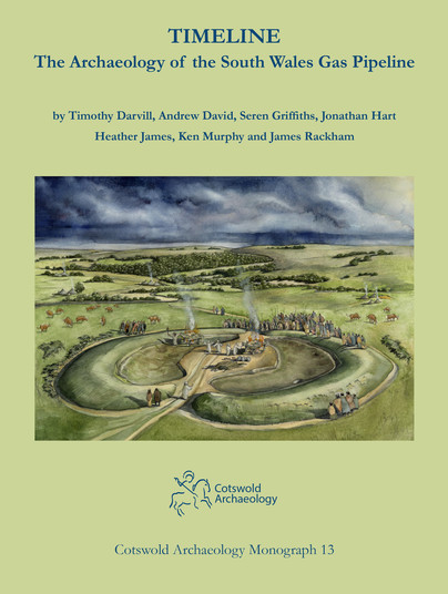
Format: Hardback
Pages: 214
ISBN: 9780993454578
Pub Date: 05 Apr 2021
Imprint: Cotswold Archaeology
Series: Cotswold Archaeology Monograph
Illustrations: 125 - colour incl plates
Description:
The construction of a natural gas pipeline across southern Wales and into Herefordshire and Gloucestershire between 2005 and 2007 resulted in numerous archaeological discoveries, including sites of national significance. The project not only produced a wealth of new archaeological sites, it also generated important radiocarbon and environmental datasets for the region.The earliest activity is indicated by worked flint of Mesolithic (or earlier) date, with the earliest Neolithic communities represented by pits, evidence for occasional timber houses, and the discovery of a previously unknown henge.
Beaker and Bronze Age settlement and burial remains were found too, including a rare copper halberd. The excavations also produced evidence for Early Bronze Age houses and numerous examples of burnt mounds.Other discoveries comprised much new evidence for Iron Age settlement (including some in areas of upland), Roman roads, crop-processing ovens, and ironworking. Rare evidence for the early medieval period was also found, along with the remains of later farmsteads and field systems. Moves towards industrialisation were reflected in the discovery of a brick kiln and charcoal-burning platforms.

Format: Hardback
Pages: 160
ISBN: 9781789256376
Pub Date: 15 Feb 2021
Illustrations: B/w and colour
Description:
With the thought of treasure, Isle of Wight islander, Derek Williams researched ancient local wreck records. Top of his extensive wreck list was the 40-gun frigate Assurance lost in 1753 while returning from Jamaica with Governor Trelawny on board, whose story possibly inspired Robert Louis Stevenson to write Treasure Island. Derek’s first dive at the western point of the Isle of Wight called “The Needles” put him on top of cannons, various wreckage and Spanish-American “Pieces of Eight”, all scattered at the foot of the rock face.
He reported this astonishing discovery to the authorities which resulted in the site being designated the 6th British historic protected wreck site. When the authorities decided that further professional help was needed, author and diver John Bingeman supplied his Portsmouth Royal Naval diving team, and together with David Tomalin, County Archaeologist, developed the full potential of this important site. Over the next nine years John Bingeman’s team conducted annual visits to excavate the site; they successfully recovered 3,471 artefacts including cannon weighing 1½ tons. Some of these cannon post-dated the Assurance, leading to the identification of a second 38-gun frigate, the Pomone, lost in 1811. Her Captain, Robert Barrie’s extensive correspondence was discovered by Paul Simpson to have been archived by Duke University, North Carolina. It features Pomone’s continuous actions during the French Napoleonic wars, followed by his appointment to the 74-gun Dragon when he saw action in Chesapeake Bay during the 1812-15 war with the USA. Returning to North America as Senior Naval Officer Canada, Commodore Barrie made quite a name for himself improving the political relationship between the USA and Canada; he is remembered by the Canadian City named Barrie. Previously un-researched archaeological finds are featured, including the development of rigging blocks, gunlocks, military buttons and ship’s chain pumps, all superbly illustrated, as well as the results of research into numerous other artefacts of the period. Appendices contain the transcripts of the two ship’s court martials and make fascinating reading. Captains seem to be blameless while their navigating officers are held responsible even going to prison. Perhaps not surprising when tried by fellow Captains!
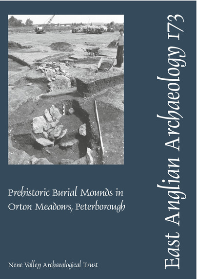
Format: Paperback
Pages: 174
ISBN: 9780952810537
Pub Date: 05 Jan 2021
Imprint: East Anglian Archaeology
Series: East Anglian Archaeology Monograph
Illustrations: 93
Description:
Construction of the Peterborough Eastern Bypass led to the excavation of a burial mound and the discovery of a complex burial and ritual site, which lay in the Nene valley on the north bank of an old course of the river. The site was effectively sealed under alluvial deposits accumulating over the last thousand years, and almost untouched by any post-medieval disturbance. A round barrow, found by David Hall in the 1970s, was a slight bump in the flood meadows, scarcely 0.
25m above the general level. When archaeological excavation began, a change in the vegetation nearby proved to be another, older, burial monument. Work was intermittent, held up by lack of funds and only completed under a government unemployment scheme. Both burial sites span the period from the Neolithic to the Middle Bronze Age with evidence that they shared a sequence of development. Iron Age weaponry and currency bars were recovered from the old course of the river Nene and there was evidence that ritual or religious practice continued at the barrow into Early Saxon times. The focus of the cult may have been the tidal effect on the Nene. Cultivation in open fields up-stream during the Late Saxon and Medieval periods led to silting of the valley bottom, almost completely covering the burial mounds, the process coming to an end progressively through the eighteenth century.
Pages: 520
ISBN: 9789088907036
Pub Date: 28 Oct 2020
Imprint: Sidestone Press
Series: The Stonehenge Riverside Project
Illustrations: 190fc/202bw
Pages: 520
ISBN: 9789088907029
Pub Date: 28 Oct 2020
Imprint: Sidestone Press
Series: The Stonehenge Riverside Project
Illustrations: 190fc/202bw
Description:
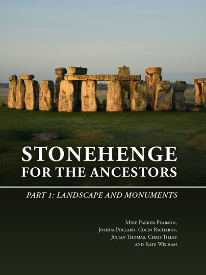
For many centuries, scholars and enthusiasts have been fascinated by Stonehenge, the world’s most famous stone circle. In 2003 a team of archaeologists commenced a long-term fieldwork project for the first time in decades. The Stonehenge Riverside Project (2003-2009) aimed to investigate the purpose of this unique prehistoric monument by considering it within its wider archaeological context.
This is the first of four volumes which present the results of that campaign. It includes investigations of the monuments and landscape that pre-dated Stonehenge on Salisbury Plain as well as of excavation at Stonehenge itself. The main discovery at Stonehenge was of cremated human remains from many individuals, allowing their demography, health and dating to be established. With a revised radiocarbon-dated chronology for Stonehenge’s five stages of construction, these burials can now be considered within the context of the monument’s development. The different types of stone from which Stonehenge is formed – bluestones from Wales and sarsen silcretes from more local sources – are investigated both at Stonehenge and in its surroundings. These surrounding monuments include single standing stones, the Cuckoo Stone and the Tor Stone, as well as the newly discovered circle of Bluestonehenge at West Amesbury beside the River Avon. The ceremonial Stonehenge Avenue, linking Stonehenge to Bluestonehenge, is also included, based on a series of excavations along its length.The working hypothesis behind the Stonehenge Riverside Project links Stonehenge with a complex of timber monuments upstream at the great henge of Durrington Walls and neighbouring Woodhenge. Whilst these other sites are covered in a later volume (Volume 3), this volume explores the role of the River Avon and its topographic and environmental evidence.With contributions by:Umberto Albarella, Michael Allen, Olaf Bayer, Wayne Bennett, Richard Bevins, Christopher Bronk Ramsey, Chris Casswell, Andrew Chamberlain, Benjamin Chan, Rosamund Cleal, Gordon Cook, Glyn Davies, David Field, Charles French, Robert Ixer, Neil Linford, Peter Marshall, Louise Martin, Claudia Minniti, Doug Mitcham, Bob Nunn, Andy Payne, Mike Pitts, Rebecca Pullen, Julian Richards, David Robinson, Clive Ruggles, Jim Rylatt, Rob Scaife, Ellen Simmons, Charlene Steele, James Sugrue, Anne Teather, Sarah Viner, Tony Waldron, Katy Whitaker and Christie Willis


